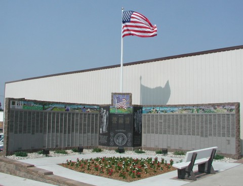
Manning Memorial Wall
Flag flying August 21, 2003
Featuring over 1000 Manning & Manning area Veteran's names.
With mosaics and etchings created by Clint Hansen of Audubon, IA. Located on the
corner of Main Street & First Street.
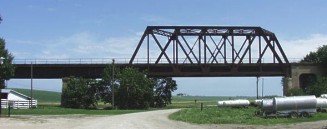
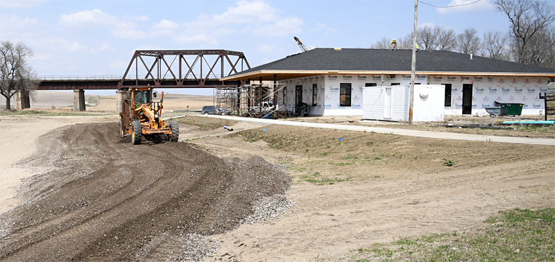
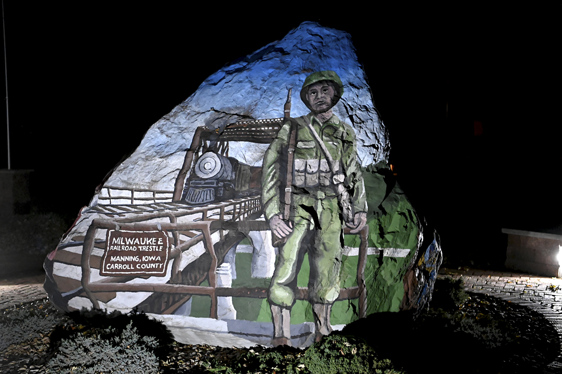
On the north edge of Manning is a very large Trestle.
This unique bridge is still in use and once carried 2 tracks for passenger trains.
It crosses the Nishnabotna river and many years ago crossed two other railroads, the
Great Western and the North Western.
"The Great Umbrella Ride"
Harold Reinke and Herbert "Hoopy" Hoover decided one day to parachute off of the trestle.
Harold used a tractor umbrella and Hoopy used his mother's umbrella
Hoopy
jumped and his umbrella inverted and down he went.
Harold jumped with his more sturdy tractor umbrella and about half way down his umbrella
inverted and down he went. At the bottom were piles of sand that they were jumping
into but even with the sand both Hoopy & Harold landed with a thud.
So ends "The Great Umbrella Ride" and fortunately these two youths were able to walk
away with only their pride a little hurt.
"The Great Bike Ride"
One day Don Petersen and some friends decided to ride a bike across the top of the bridge
beams on the trestle. Don got part way across and some of the kids yelled that the cops were
coming and so ended the Great Bike Ride. Don is a brother to Elaine (Petersen) Reinke and they
are the children of Olivia Petersen.
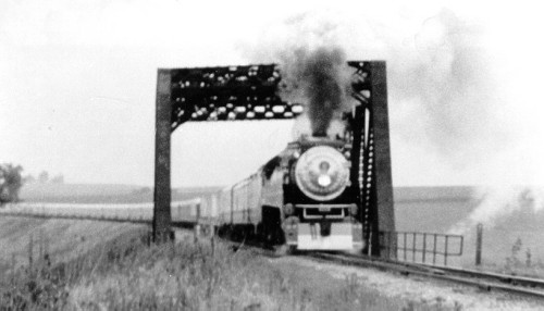
In 1976 the "Freedom Train" which toured the U.S during the Bi-Centennial crossed this
trestle.
This bridge was protected by guards during WWII because of fears that the Japanese or Germans
would attempt to blow it up.
In 1969 a saboteur used dynamite to derail the passenger train hoping that it would
careen into the Nishnabotna river below (fortunately the train came to a safe stop but not until it
derailed).
Manning is generally a quiet community but it does have its moments of excitement
too! (for more
information on the railroads)
During WWII, this trestle bridge was guarded for fear of Japanese or German sabotage.
Many military and troop trains traveled on this RR track and the other two, the Great Western and Northwestern RR tracks.
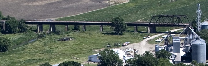
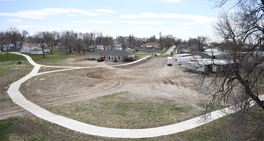
Present site of Trestle Park and the Milwaukee Depot shelter house Milwaukee Depot shelter house This structure is based on original blueprints of the original Manning Milwaukee Depot.
Trestle Park and trail
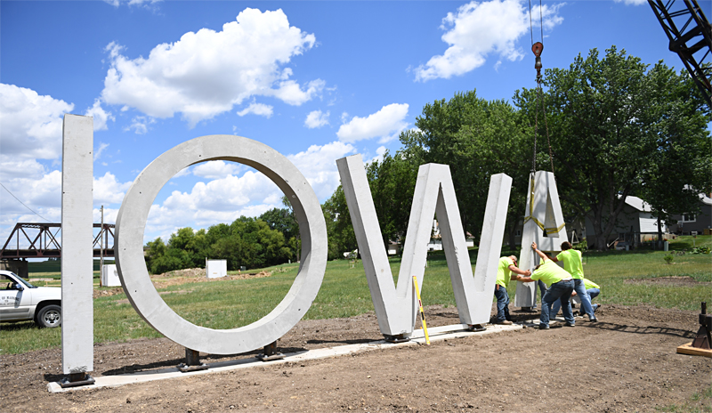
IOWA sign erection June 2017
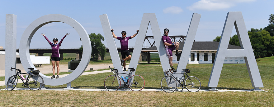
RAGBRAI July 2018
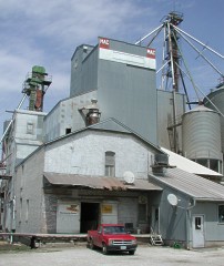
Just south of the Trestle once stood the West Central Coop - formerly the Manning Agriculture Center.
The original part of the mill was once owned by Royal H. Doud, grandfather
of Mamie (Doud) Eisenhower, who was wife of U.S. President David Dwight Eisenhower..
Sadly, the whole complex, including the Doud Mill part was torn down in 2016.
(for more information click here)
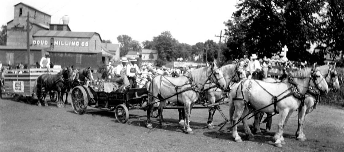
Manning's 50th anniversary parade in 1931 - Doud Milling Company in the background.
Manning has full rail service through the Burlington Northern. The AGP soybean processing plant in Manning
and the Ethanol plant in Coon Rapids are major agricultural businesses connected to this railroad.
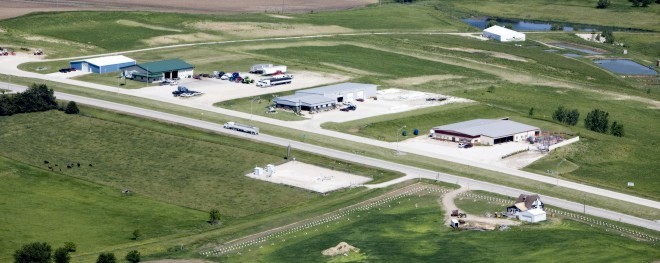
On the west and northwest edge of Manning is the new industrial area with room for expansion and a connection to the railroad.
This area is also home to West Central Iowa Rural Water Association - 2nd large building from the right.
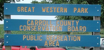
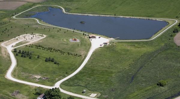
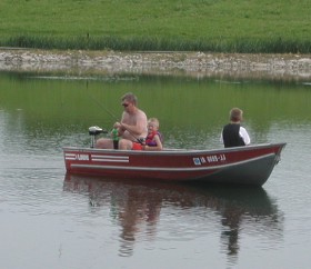
On the southwestern edge of Manning is the Great Western Park.
The original pond (12 acres, 14 feet deep with boat ramp) was
recently restored and the whole park is continually being developed.
There is a shelter house, trail, and camper parking with water and electrical hook-ups.
A dumpstation is located by the restrooms near the shelter house. For camping fees and other information - Phone (712) 792-4614 and E-mail info@carrollcountyconservation.com
Large Mouth Bass, Crappie, Bluegill & Catfish are in the pond.
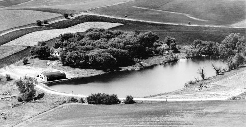
Early 1950s view looking southwest.
Manning Heritage Park & old Willow Creek Park
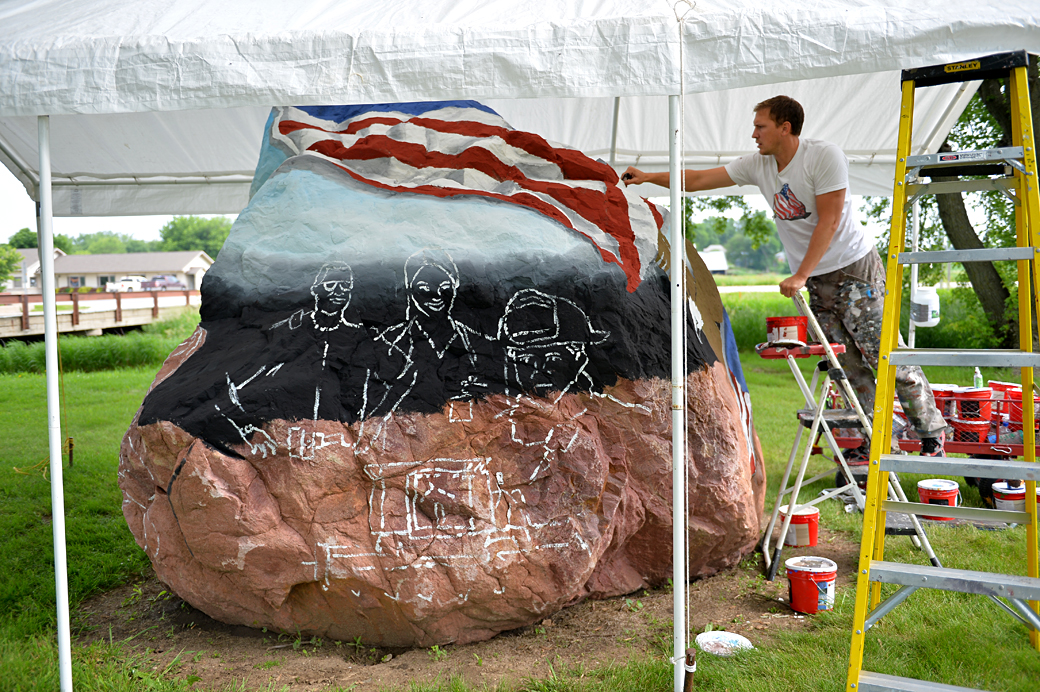
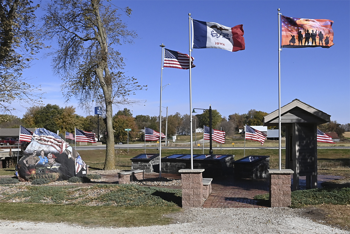
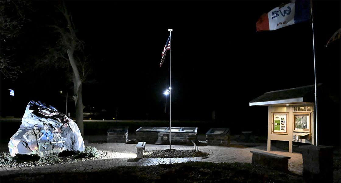
In 2014, Ray "Bubba" Sorensen came to paint Carroll County's "Freedom Rock" which is standing in the old Willow Creek Park, now part of the Manning Heritage Park.
Ray is painting a bolder in each of the 99 counties in Iowa, and thanks to the alert members of the Manning VFW they found a bolder and contacted Ray to get the Carroll County
rock located in Manning. To see the amazing designs on the whole rock, you'll have to come to Manning to see it.
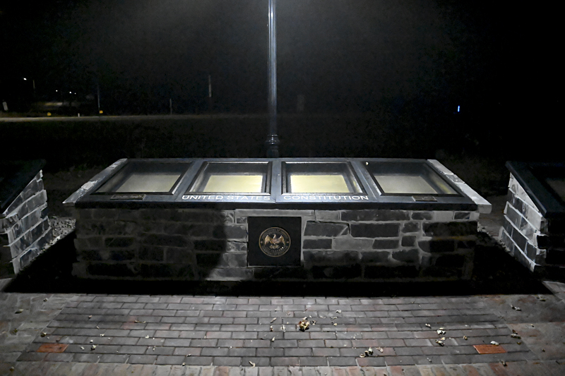
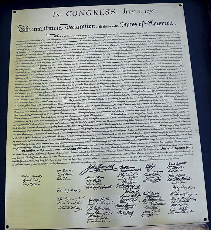
Charters of Freedom - First in Iowa!
Manning has 5 places to enjoy a sit-down meal.
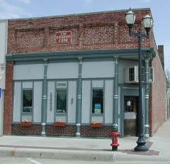
Deb's Corner Cafe located on Main Street on the east side.
This building was originally part of the "Horse Shoe Bar" which was touted by the Dubuque Brewing and Malting Co., brewers of Banquet Beer, as the longest bar west of the Mississippi River. The bar was of solid mahogany, was 120 feet long and took eight bartenders to service.
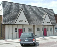
Cliff's Place located on Main Street on the west side.
Cliff Waterbury and family established the business June 14, 1976.
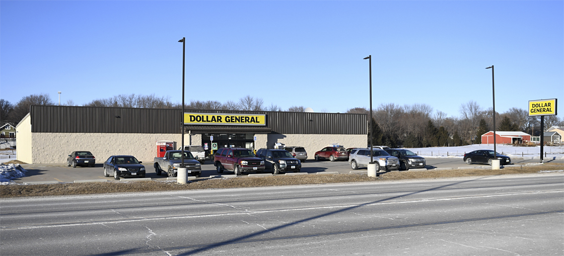
Dollar General New store opened March 2021 located on the east end of 141 in Manning
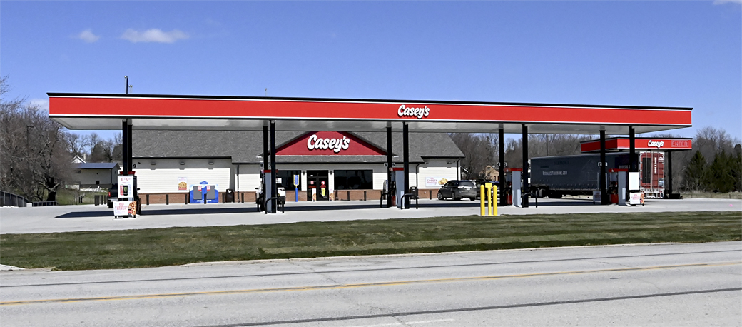
Caseys New store opened in 2016 located on the east end of 141 in Manning
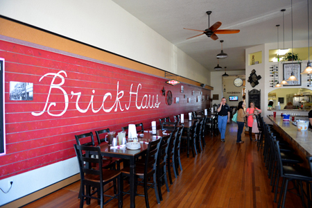
Brick Haus Brew 3rd & Main - formerly Mueller Furniture store
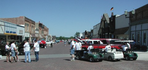
Another attraction is Main Street brick paving (bricks laid in 1915). Several annual community events are held on Main Street including Childrens Day and
Weihnachtsfest.
I hope you enjoyed the quick tour of Manning, Iowa --- A community of hard-working
people who are proud of Manning's history that was built by immigrant pioneers
seeking a better life for all who moved here.
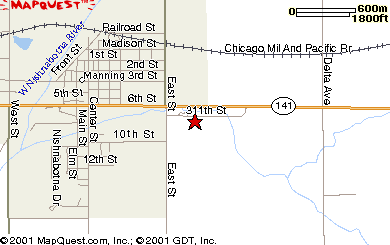
(the red star on map above is the approximate location of the Heritage Park/Hausbarn site.)
Manning is approximately a 1.5 hour drive by car from Omaha, Nebraska & Sioux City, Iowa & Des Moines, Iowa.
If you draw a triangle on a map using these three towns as the points Manning will roughly be in the middle of the triangle.